![]()


At 7:19 p.m., a Dash 8 on a 4-mi. final for Runway 26R at Vancouver was struck by lightning. The aircraft landed safely.
Fifteen minutes later, a Boeing 767 on an 8-mi. final for the same runway was also struck by lightning. This aircraft also landed safely.
Ten minutes later, yet another aircraft, a Boeing 737 4 mi. back from the same runway threshold, was struck by lightning, but it too landed safely.
So, over a 25-min. period, there were three approaches and three lightning strikes.
How many other aircraft pressed on, unscathed, through the thunderstorms during the evening rush hour?
The three unfortunates who were struck were all equipped with weather radar. It is hard to believe that, flying through an area of active cumulonimbus clouds (CBs), the pilots did not have the scopes lit up; that pilots would deliberately push through active CBs on the approach path that the first pilot did not report the strike immediately; that the controller did not warn off the other arriving aircraft; and that the following pilots chose not to hold until the storm had passed.
The lightning could easily have fried the aircrafts electronics, and the potential hazards of hail, severe turbulence and windshear were all there.
Is meeting the schedule worth the risks?
Originally Published: ASL 3/1997
Original Article: Struck by Lightning
But I Could Hit a Hill...

GPS direct? Check terrain clearance.
Almost from the day that Doug McCurdy lifted the Silver Dart off the frozen surface of Bras d'Or Lake, pilots have sought a reliable way to stay on track while traversing the vast wilderness that makes up so much of Canada.
In the bad old days, they used maps. Often, the maps were inaccurate. But as time wore on, the maps got better. In many areas of the country, that wasn't much help. One little lake looked much like another. So did the valleys and what-not. On a clear day, it didn't matter too much. Pilots could see for miles, and generally stayed somewhere near the intended track.
Some of the time, it wasn't clear. Oh, there was generally enough visibility to remain in visual meteorological conditions (VMC) in visual flight rules (VFR) flight if one was flexible about how one interpreted one or two miles, but map-reading became much more difficult under those conditions.
Over the years, maps and NAVAIDs improved. Still, for most pilots, the only time they were on track was when they unknowingly crossed it. As a result, many aviators spent considerable time being momentarily unaware of their position. For some, that moment stretched to eternity.
To get around such unhappy accidents, many incredibly talented people developed a navigation system so accurate that it could be and is used in some cities to deliver pizzas to specific residences. Aviators soon found that this system, known as the Global Positioning System (GPS), could be used to supplement the map-reading skills that were the bedrock of their VFR navigation over remote terrain. As a result, pilots flocked to buy GPS receivers that would keep them right on track.
As more and more pilots began using GPS, they started developing a great degree of confidence that it would always lead them to their destination. Confidence is one thing, over confidence another. We've had a lot of reports that pilots with GPS sets are setting out on VFR flights that they would have cancelled in the past because the weather was marginal or because it was dark. This attitude has a lot of accident potential. First of all, GPS is not infallible. As we've said many times in the past, GPS satellites can transmit faulty signals and, unless you have an installation certified for instrument flight rules (IFR) flight, you won't be warned. Faulty satellites have caused 80-mi. position errors in the past. Even if you have an IFR box, there will be times when there just won't be enough satellites to navigate. What if this happens at a critical point in your flight when the visibility is too poor to map-read?
Even if there are lots of satellites and they're all working properly, all that GPS can do is take you to the waypoints you've programmed into the box. What if you've entered the wrong coordinates? Even experienced airline crews flying 747s have made this mistake, so what makes you immune? If you can't see the ground well enough to confirm you're on track, how will you know if your mistake is leading you into the side of a hill?
On the subject of controlled flight into terrain (CFIT), let's suppose that GPS is working flawlessly and you've entered the correct waypoints. You'd still better have plotted your track on a map and checked for obstacles. Not just along the track, but to either side as well, and don't forget to look for obstacles below the altitude you intend to fly.
If the weather is already bad, it could get worse, and you might have to descend or deviate. The course you've plotted may not give you these options, and so now you're betting your life on the weather not changing. Does this sound like a good idea to you? Suppose you can deviate and find some better conditions. Now you'll likely use the "direct-to" feature on the box to continue to destination. You'd better have another look at the map at this point. Plot your new track to destination and follow all the advice we've given above.
For years, pilots wanted a navigation system to keep them precisely on track all the time. Now that we have it, some are replacing the risk of getting lost with the risk of flying into an obstacle. VFR navigation means being able to see the ground well enough to navigate safely.
There's no category between VFR and IFR. Make a choice, and follow the common-sense rules that go with your choice!
Originally Published: ASL 3/1997
Original Article: But I Could Hit a Hill...
Into the Snow and Rain — Controlled Flight Into Terrain
Put yourself in this position:
You're a very experienced pilot, with a very experienced co-pilot along for the ride. However, neither you nor your co-pilot has much mountain-flying experience. Your aircraft has just been completely rebuilt and is fresh off a successful test flight. You've had an extensive weather briefing, and the forecast is "good VFR" with occasional reduced visibility in snow. The FSS specialist recommends the Skeena Valley VFR route because of lower altitude requirements should you run into adverse weather, but you have a pilot report (only 2.5 h old) from the Telkwa Pass, indicating a 3500-ft. ceiling, with visibility occasionally down to 10 mi. in light snow. You select the Telkwa Pass because its so much shorter.
You're now penetrating the British Columbia coastal mountains from Terrace to Smithers, flying toward the Telkwa Pass through occasional snow showers. Thirty miles cumulus, virga and rain in all quadrants. Do you continue? If you do, are you spring-loaded to perform a 180· turn in a very tight mountain pass?
One 10,000-h pilot continued, and wasnt prepared.
The wreckage was located in an avalanche area at the bottom of a recent slide. The engine was at the 7000-ft. level, and parts had slid down more than 3000 ft. Neither pilot had survived. Because of the treacherous area, a detailed investigation could not be completed. However, it is more than likely that the pilot turned a corner and flew into instrument conditions - and into the towering mountain.
Originally Published: ASL 3/1997
Original Article: Into the Snow and Rain - Controlled Flight Into Terrain
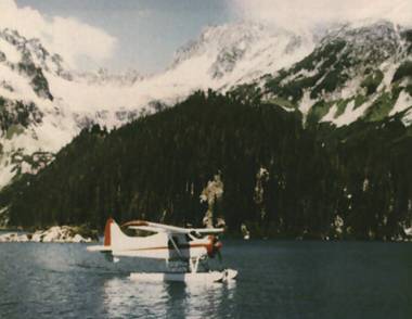
On July 20, 1996, Pierre Meloche, President of the Association des pilotes de brousse du Québec (the Quebec bush pilots' association) died in a tragic seaplane accident. He drowned while trying to save his passengers after his Cessna 206 flipped as he was attempting a heavy water takeoff from Rivière des Prairies.
Pierre managed to rescue two of his six passengers, but, sadly, he and four others drowned.
"Learn from the mistakes of others; You'll not live long enough to make them all yourself ..." has long been the banner of Transport Canada, System Safety. The following letter by George C. Velguth was originally published on the Internet and in the November/December 1996 issue of Water Flying. It sets an example we can all follow in learning from others:
The tragic Meloche accident has catalyzed me to stop merely thinking about steps to enhance my ability to egress an inverted floatplane and start implementing them. I was especially moved by the fact that his friend had apparently established his own avenue of escape, then drowned [while] attempting to save the children. Of course, any of us would probably do the same.
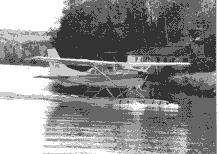
File C206 photo
However, in an attempt to avoid having to make such a choice, these are the steps I have decided upon:
Installing Citabria type, emergency-door hinge releases on all floatplane doors. Had these been in place in the subject 206, the tragedy Louis reported might have been reduced to the level of an embarrassment. This actually sounds like a good idea for all airplanes. I have seen these devices on a Cessna 175 floatplane, but know nothing about their availability. Anybody have any info?
Replacing my lap belt only restraint system with front- and rear-seat harnesses. It will do no good to install quick-release door mechanisms if I am knocked unconscious during a roll over. Does anyone have experience with the BAS inertia reel retrofit?
Outfitting each occupant with CO2 type PFDs [personal floatation devices]. While I am certainly concerned about my ability to extricate my children from an inverted floatplane, I am just as concerned about them drowning after extrication. Once [the floatplane is] inverted, it is too late to locate and don life vests. I will equip my personal PFD with first-aid supplies, matches, space blankets, etc. and a two way radio.
Stopping using a hand held GPS [Global Positioning System] with wires dangling all over the cockpit. I will install connectors for the GPS so [that] there is no risk of becoming entangled during egress. My portable intercom is due for the same treatment.
Giving every passenger a thorough preflight briefing on egressing an inverted floatplane, to include practice removing seat belts and opening doors. I have often forgone this briefing for fear of alarming passengers. Louis' tragedy has finally shaken some sense into me: I'd rather lose a ride (I do this commercially) than fly a passenger who is mentally unprepared for the most likely accident scenario.
Installing and utilizing baggage tiedown anchors. During many flights I am required to carry ballast for C [of] G [centre of gravity] reasons. To date, this has consisted of a couple [of] concrete blocks, unsecured, in the baggage compartment. Leaving these heavy things as a result of their tragedy. I know that I will never forget the story [that] you told in your post. It will become part of the training [that] I give to all future seaplane students.objects unsecured has been stupid. The above-mentioned safety steps would be for naught if a 36 lb. chunk of concrete were to smash into the back of my head during a roll over.
Finally, resolving to heighten my own level of awareness and diligence. I know [that] I too have made poor takeoff decisions. The next time [that] I am facing high winds, rough water, short take, [a] heavy load, etc., I will be thinking of this accident, and my decisions will be more conservative because of it.
The tragedy which overtook the Meloche family just happens to be my aviation nightmare. This is certainly why it affected me so. If it is any comfort at all, please know that at least one float pilot is changing the way he does things as a result of their tragedy. I know that I will never forget the story [that] you told in your post. It will become part of the training [that] I give to all future seaplane students.
Originally Published: ASL 2/1997
Original Article: Learning From Others


Pilot Resources
Ask ATS
Weather
TSB
Interactive Materials
NOTAMs
Air Safety Institute
ELTs
Aviation Safety Letter
SmartPilot proudly works with.


We would like to acknowledge the financial support of the Government of Canada for this initiative through the Search and Rescue New Initiative Fund (SAR NIF).